
Central Great Barrier Reef is now available in the Atlas
May 15, 2019This is the Great Barrier Reef’s newest milestone. Today, the Central Great Barrier Reef, from Cairns to Cooktown, was added to the Allen Coral Atlas. The newly mapped region provides a deeper understanding of the coral environment, including the Atlas’s rich data in benthic, geomorphic, and bathymetric layers. 237 reefs are now viewable online, making this the largest addition to the Atlas so far.
This new dataset covers 3,000 km squared of coral reef, about 10% of the entire GBR. No other region in the world shows this many reefs, mapped at this level of detail, and captured all at once. For the Allen Coral Atlas team, this was a unique opportunity to push our mapping skills further.

Full extent of the new data released today.
We set out to add the first large region to the Atlas by starting in familiar areas where we’re confident with our mapping experience. The Remote Sensing Research Center at the University of Queensland already had deep expertise in the Central GBR region. From there, the Allen Coral Atlas partners collaborated to produce the map. Planet’s Dove Satellite images were then processed by the Center for Global Discovery and Conservation Science at Arizona State University to derive bottom reflectance and depth. National Geographic leads field engagement at reef locations and in the coral reef community.
Adding these maps gives the reef a fighting chance. The Central Great Barrier Reef has been damaged by tropical cyclones, bleaching events in 2016 and 2017, sedimentation, crown-of-thorns starfish, careless tourism, and other environmental threats. With a monitoring and mapping system like the Atlas, the region can make educated decisions about conservation and restoration.
We’re one step closer to our goal of mapping all reefs. Mapping individual locations around the world would be a slow process. Instead, we’re working region by region to expand Atlas coverage quickly and more systematically. Documenting every region gives us visibility into the features at each coral reef. Using the same mapping methodology for all world regions allows us to compare different reefs to each other; close together and far apart. For the first time, people can finally get a sense of the potential comparisons and revelations waiting below the surface.
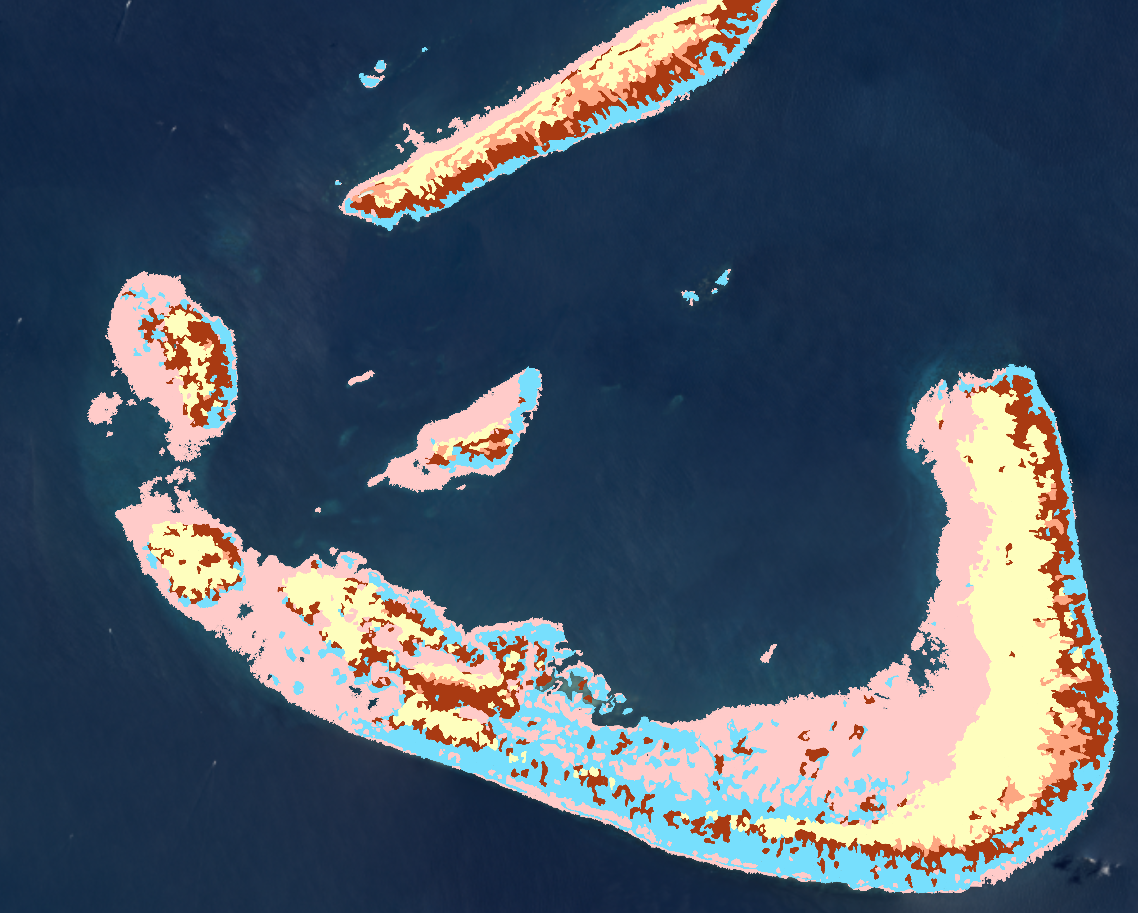
Arlington Reef, 30 km from the city of Cairns
When exploring the newly mapped area today, people can begin their own comparisons right away. Draw a polygon around part of the reef to create an area of interest, and then compare areas of interest in different reefs!
The Central GBR is complete, and the Atlas team is geared up to publish the next regional map in summer 2019. Thanks to all the partners and teams who made this happen.
We’re thrilled to include this new data in our Atlas! This is only the first version and there will be more to come.
Interact with the Central GBR directly in the Atlas
Your feedback about the Atlas is always welcome. Drop us a note: support@allencoralatlas.org (We're nice!)